- Screen Colours:
- Normal
- Black & Yellow
 People have lived here for at least 1000 years, farming on the light soil, keeping pigs in the woods where they obtained firewood and timber for their houses; and getting clean water from the streams.
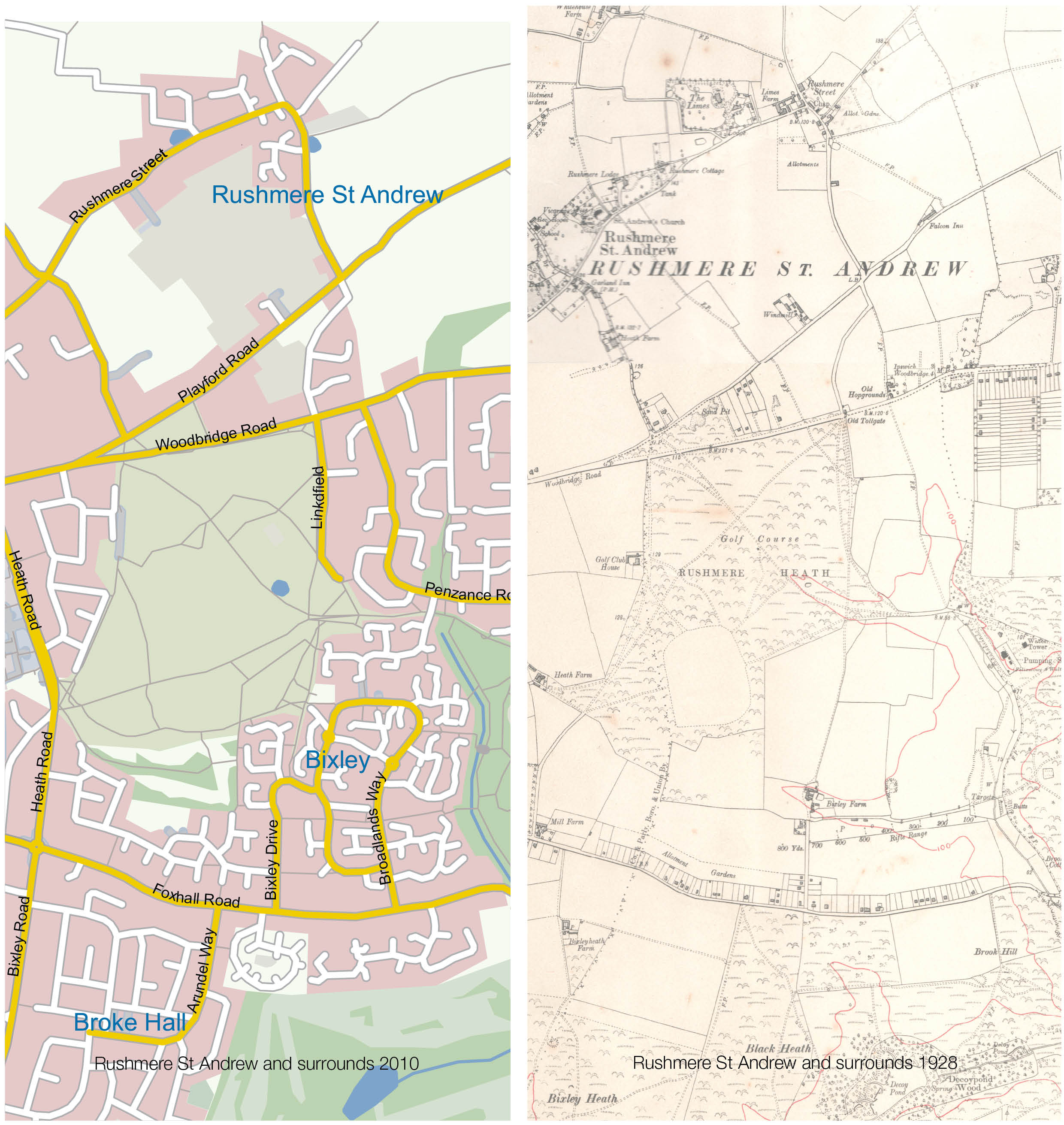
Rushmere – a mere or lake where the rushes grow. Rushes grew at the Decoy ponds in the sub-manor of Bixley, now outside the southern parish boundary. The light sandy soil and rich loam were easy to work with ancient ploughs. Pre-1700 there was mixed farming of arable and livestock, later mainly corn and barley. Several hop fields were to be found near Bent Lane and Bixley Decoy Ponds. Since 1959 several farms have been developed into housing estates, though the north of the parish remains as open countryside crossed by the railway line between Ipswich and Woodbridge.
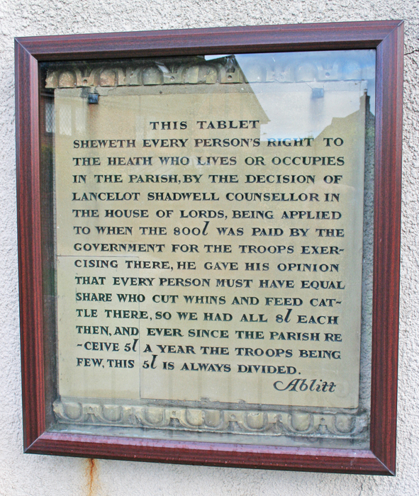
All the parish landowners, i.e. most residents, have had ‘commoners’ rights on the heath since 1881.
In 1803 troops fighting Napoleon trained on the Heath, 10,000 of them in 1813. From 1814 to 1819 payments were made by the government for damage by troop activity. A plaque about this was set up in 1861 and can now be seen on the wall of the Baptist Church in the village.
Public executions included that of John Hodgson, 26, for highway robbery and defrauding the army of £600 by enlisting no fewer than 98 times and receiving payments but rarely performing any military duties. Thankfully, the gibbet which was located on the heath close to the present A1214, has long since been removed.
The Saint Andrew part of the village name refers to the church which was built on Saxon foundations. In 1086 the church had 20 acres valued at 40 old pence. By the mid 12th century a stone church with Norman doorway had been built. In 1828 a large brick schoolhouse was built on the north side of the nave, attended in 1833 by 50 children. In 1861 the church was entirely rebuilt due to the fabric of the building being in a ‘ruinous condition’.
The Tower contained six bells, two made in Ipswich in 1675, three made in London between 1426 and 1456, the last and sixth was made in London in 1885. The village pond is by The Limes, about a quarter of a mile east of the church. Beside it is the village sign erected in 1980, showing St Andrew’s Cross and the local ducks. Further east, just beyond Holly Lane, is the Baptist Church built in 1859 and nearby is Chestnut Pond.
The first of the village halls (erected in 1921, rebuilt in 1991) stands in Humber Doucy Lane near the original village school built in 1846. The bell from the old village school is now housed in the entrance of Broke Hall County Primary School. On the opposite side stood Rushmere Hall built in the 1600s but reduced to a farmhouse by 1846. Humber Doucy Lane is now outside the present parish boundary and forms part of Ipswich.
The workhouse known as Heathfields Poor Law Institution, built in 1898 stood on heathland near the corner of Woodbridge Road and Heath Road, which by 1912 housed 385 inmates and 17 officials. With the demise of the Poor Law system in 1930, it became the Ipswich Borough General Infirmary. Some of the buildings still survive as part of Ipswich Hospital NHS Trust. The old Tollgate, standing at the junction of Bent Lane and Woodbridge Road, was demolished in the 1930s.
With the building of the large housing estate on Bixley Farm in the 1990s, a community hall was built along with a playground, nursery and shops. A second village sign depicting the water tower and the Common was also erected along Bladen Drive.
Past & Present Maps of Rushmere St Andrew